Seiten

Posts mit dem Label Google Sheets; Google Maps Engine werden angezeigt. Alle Posts anzeigen

24.06.14

Going (almost) paperless with free Google tools

I’ve been organizing a one week school trip to England with about 30 students and I am astonished  by the vast amount of not only paperwork but actual paper such a trip still requires in 2014, when all my students are equipped with computers and smartphones. Starting from catalogues of tour operators to endless lists for payments, passport numbers and host families the paper flow just doesn’t seem to stop. One thing that has particularly puzzled me is that I had to ask for a digital copy of anything I received from the tour operator, including boarding passes and addresses of our host families. In order to reduce the amount of paper I have tried to use electronic tools between me and my students when collecting data and sharing information as much as possible. These include:


Student information
I collected almost all of the information (phone numbers, email addresses, parent’s phone numbers, etc.) I needed via Google Forms (see here) and then exported the contact details to my Gmail contacts to have my students’ and their parents’ phone numbers available in case of an emergency.


Travel documents and information
I have shared some important travel documents and information via Gmail and Google Drive. In particular students should have their boarding passes and the addresses of their host families available on their phones. Other, less essential, information includes: travel guides, tube map, bus timetables in PDF format (these are also available as apps).


Programme
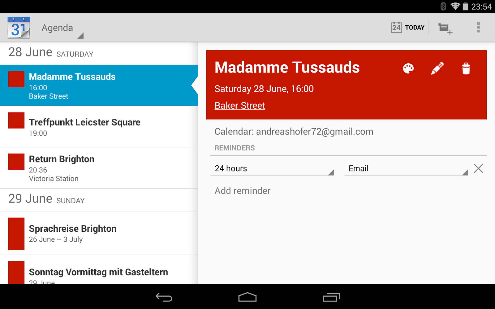
I created the programme in a Google Doc initially when it occurred to me that the best way of doing the programme is using a sheet. This allows you to quickly create a (shareable) Google Calendar, which is much more flexible than a conventional table: different views (most useful ones being the agenda view and the weekly calendar), it automatically creates links to Google Maps if you specify a place, students can import the calendar in their calendars and you can update events in real time.
i.png

Maps
Of course maps are always useful when travelling. For this particular trip I have created a map in Maps Engine for our day trip to London custom placemarks as well as a map of the host families homes. The latter can be easily created from a Google Sheet.


Checklists, vouchers, etc.
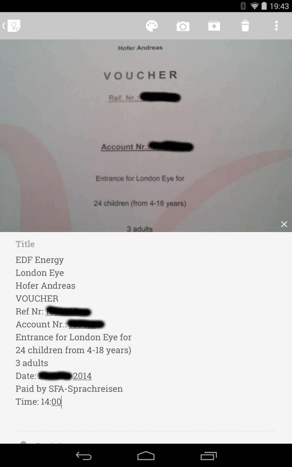
For some kinds of information Google Keep is more convenient than Google Drive. Google Keep is way faster than Drive and you don’t have to enable offline availability first as in Drive.  I created a quick copy of a number of documents with my phone and then sent the image to Keep and had the text transcribed (as in the example of the voucher below). Checklists are another thing that are easier to do in Keep than in Drive. I keep a checklist of all participants in a note, which I can copy spontaneously for whatever purpose might come up.
voucher.png

20.06.14

Creating customized maps for school trips

When it comes to maps Google services are even more confusing than when you are undecided where to upload photos to (Drive, Picasa or Google+). There is  a wild variety of options:

  1. classic My Maps for creating a Google Map
  2. more recent Maps Engine (lite) to create maps on separate layers
  3. geocoding locations in Fusion Tables
  4. geocoding locations in Google Sheets using an add-on
  5. recording a trip, route or tour with MyTracks  Android App and saving to Drive
  6. placing photos on a map using Picasa (not available in G+ Photos yet)
  7. creating a tour on Google Earth


In the past I used options 1 and 5 most frequently for creating maps for school trips and for presenting them with photos on a map on Open Days, etc. Google has made it clear, however, that it is favouring Maps Engine over other services (e.g. by changing the export option in MyTracks to MapsEngine from MyMaps and Fusion Tables) when it comes to custom maps. For this reason I have decided to give it a try in a real life situation. For my upcoming trip to England I needed to create two maps (and share them with my students).


A) Creating a map  of all host families where the students are accommodated using Google Sheets
2014-06-20_09-10-37.png
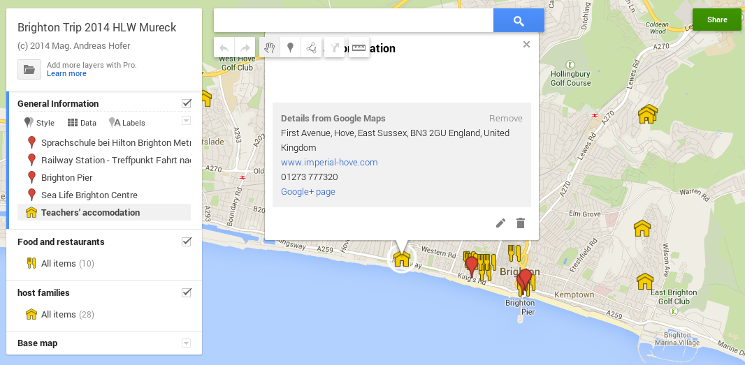
We will be staying in Brighton for a week and I have created a map of Brighton containing three layers (maximum for the lite version): general information, restaurants and host families.
The information for the “host families” layer comes simply  from a Google sheet which I received from the tour operator and which I imported right after creating the layer. When importing you need to tell Maps Engine which column to geocode. The final step is to change the placemark icon. I have used houses for accommodation and knife and fork for restaurants.


B) Creating a map for a day trip to London including walking route and meeting points
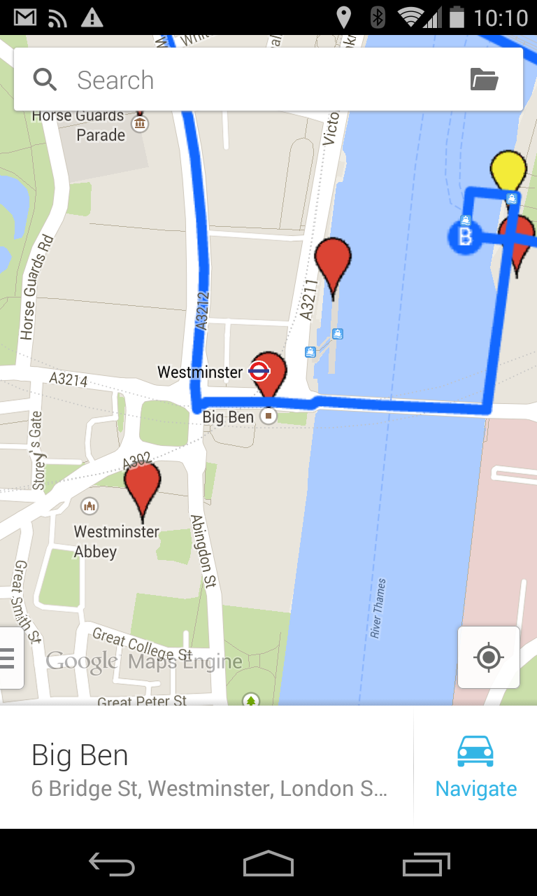
We will go on a day trip to London as well. So I have created a map which shows the route we will be taking using the walking route tool (first click on the draw line tool and then choose the walking route). It works very intuitively: just drag and click to add places.
Then I added some general places of interest which the students will be able to visit on their own during free time on a separate “sights” layer. And finally I colored in the meeting points.


Screenshot_2014-06-20-10-10-10.png

Creating these maps was fun and easy, despite my initial reluctance to use Maps Engine. I would have preferred Google MyMaps instead. Apart from having the disadvantage that you have two different apps both on the web and on mobile, the biggest drawback of Maps Engine is that you can’t save a map on a mobile device like in Google Map, which of course would be highly useful on a trip abroad.


Having said that, there are also a number of nice features to Maps Engine:
  • It works like other Drive apps including sharing, publishing and embedding
  • Layers are definitely a bonus as they make the map more legible
  • Importing data from a Google sheet and automatic geocoding is a huge time saver
  • The mobile app allows you to use the phones sat nav system
  • You can export in kml format (e.g. to Drive just to keep a backup, or to Google Earth for a presentation)

Beliebte Posts